
Photo:Chocolate Hills. Source
No one really knows how or when the between 1,268 and 1,776 Hershey's Kisses shaped hills were either formed or constructed near Bohol, Philippines.
The hills range in height between 150 to 450 feet high and are very regular in shape. The theories have hardened into fact; they were created through some geological process and are NOT man made.
If you were to do research on the hills you would find that a great deal
 of information has simply been copied from one site to another and a
very common sentence is; "you will be very surprised to find out that
the hills are not man-made".
of information has simply been copied from one site to another and a
very common sentence is; "you will be very surprised to find out that
the hills are not man-made".We're not arguing that they aren't geological; that's what the experts have done; argue over various proposed geological processes that whatever they were - seemingly only ocurred here. What we do note is how the experts come in and even though they differ--they have made the official proclamation that they are geological and so now; they ARE geological. Perhaps they are right but since they don't know WHAT geological process created them, making definitive statements about there origin would seem to be premature. This is how science works; speculation, favored speculation--incontrovertible fact.

"The Chocolate Hills are an unusual geological formation in Bohol, Philippines. According to the latest accurate survey done, there are 1,776 hills spread over an area of more than 50 square kilometres (20 sq mi). They are covered in green grass that turns brown during the dry season, hence the name.
The Chocolate Hills are a famous tourist attraction of Bohol. They are featured in the provincial flag and seal to symbolize the abundance of natural attractions in the province. They are in the Philippine Tourism Authority's list of tourist destinations in the Philippines; they have been declared the country's 3rd National Geological Monument and proposed for inclusion in the UNESCO World Heritage List.
The Chocolate Hills is a rolling terrain of haycock hills – mounds of general shape which are conical and almost symmetrical. Estimated to be at least 1,268 individual mounds to about 1,776, these cone-shaped or dome-shaped hills are actually made of grass-covered limestone. The domes vary in sizes from 30 to 50 metres (98 to 160 ft) high with the largest being 120 metres (390 ft) in height. They are scattered throughout the towns of Carmen, Batuan and Sagbayan in Bohol. Bohol's "main attraction", these unique mound-shaped hills are scattered by the hundreds on the island's central plain, concentrated near the town of Carmen.
During the dry season, the precipitation is inadequate such that the grass-covered hills dry up and turn chocolate brown. This transforms the area into seemingly endless rows of "chocolate kisses". The branded confection is the inspiration behind the name, Chocolate Hills.
Origin
 The Chocolate Hills are conical karst hills similar to those seen in
the limestone regions of Slovenia, Croatia, northern Puerto Rico, and
Pinar del Rio Province, Cuba. These hills consist of Late Pliocene to
Early Pleistocene, thin to medium bedded, sandy to rubbly marine
limestones.
The Chocolate Hills are conical karst hills similar to those seen in
the limestone regions of Slovenia, Croatia, northern Puerto Rico, and
Pinar del Rio Province, Cuba. These hills consist of Late Pliocene to
Early Pleistocene, thin to medium bedded, sandy to rubbly marine
limestones.These limestones contain the aboundant fossils of shallow marine foraminifera, coral, mollusks, and algae.The Chocolate Hills consist of conical karst hills, called mogote, created by a combination of the dissolution of limestones by rainfall, surface water, and groundwater and their subaerial erosion by rivers and streams after they had been uplifted above sea level and fractured by tectonic processes.
These hills are separated by well developed flat plains and contain numerous caves and springs. The Chocolate Hills are considered to be a remarkable example of conical karst topography.
The origin for the conical karst of the Chocolate Hills is described in popular terms on the bronze plaque at the viewing deck in Carmen, Bohol. This plaque states that they are eroded formations of a type of marine limestone that sits on top of hardened clay. The plaque reads:
The unique land form known as the Chocolate Hills of Bohol was formed ages ago by the uplift of coral deposits and the action of rain water and erosion.
The plaque also makes reference to a fanciful explanation of the origin of the Chocolate Hills that is unsupported by any published scientific research, i.e. either Hillmer or Travaglia and others, when it states::
the grassy hills were once coral reefs that erupted from the sea in a massive geologic shift. Wind and water put on the finishing touches over hundreds of thousands of years."
Chocolate Hills in Bohol
Photographer Salvador Andre notes:
"Most people who first see pictures of this landscape can hardly believe that these hills are not a man-made artifact. However, this idea is quickly abandoned, as the effort would surely surpass the construction of the pyramids in Egypt. "The Chocolate Hills is a rolling terrain of haycock hills — mounds of general shape which are conical and almost symmetrical. Estimated to be at least 1,268 individual mounds to about 1,776, these cone-shaped or dome-shaped hills are actually grass-covered limestone hills. The large and numerous perfect domes vary in sizes from 30 meters to 50 meters high with the largest being 120 meters in height.
Further: "There is no natural formation like them in the world. From a distance, they look like half a ball grown out of the ground.The molehill-shaped and almost uniformly sized hills dot the landscape with green and brown. "
Aesthetically extensive, they are scattered throughout the towns of Carmen, Batuan and Sagbayan in Bohol. Bohol's "main attraction", these unique mound-shaped hills are scattered by the thousands on the island's central plain, concentrated near the town of Carmen.
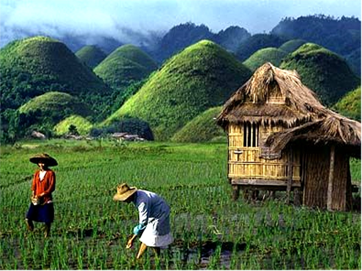
At dawn or at sunset, the Chocolate Hills are an alluring sight; the whole area picturesque amidst the rice fields and the clusters of houses made of the diamond patterned sawali or bamboo slats.
During the dry season, the precipitation is inadequate such that the grass-covered hills dry up and turn chocolate brown. This transforms the area into seemingly endless rows of "chocolate kisses". The branded confection is the inspiration behind the name, Chocolate Hills.

Photo:Source
The Chocolate Hills and the area around it have relatively flat to rolling topography with elevation ranges from 100 meters to 500 meters above sea level. Higher karstic hills dominate the landscape inland then turning almost uniformly and naturally molded in Carmen.
The vegetation of the Chocolate Hills is dominated by hardy grass species such as Imperata cylindrica and Saccharum spontaneum. Several Compositae and ferns also grow on the hills. In between the hills, the flat lands are cultivated to rice and other cash crops. However, the natural vegetation on the Chocolate Hills is now highly threatened by quarrying activities.
There are a number of geological proposals regarding the formation of the hills. These include simple limestone weathering, sub-oceanic volcanism, the uplift of the seafloor and a more recent theory which maintains that as an ancient active volcano self-destructed, it spewed huge blocks of stone which were then covered with limestone and later thrust forth from the ocean bed.
Geologists have actually long debated about the formation of the hills, resulting in various ways the origin of the Chocolate Hills are stated or explained. The one written on the bronze plaque at the viewing deck in Carmen, Bohol states that they are eroded formations of a type of marine limestone that sits on top of hardened clay.The plaque reads:
"The unique land form known as the Chocolate Hills of Bohol was formed ages ago by the uplift of coral deposits and the action of rain water and erosion. "
Another statement says: "the grassy hills were once coral reefs that erupted from the sea in a massive geologic shift. Wind and water put on the finishing touches over hundreds of thousands of years. "
Still another way the origin is stated is that they were formed centuries ago by tidal movement and by the uplift of coral deposits and the action of rain water and erosion. Another theory is that they were ancient coral limestone reefs shaped by many thousands of years erosion by both water and wind. Geologists think that the specific shape of the hills is caused by the influences of the weather during millions of years.
The breaking down of the upper layers of the limestone formations, followed by the erosion processes, resulted in these remnants in the shape of cones. It is likely that they were once limestone deposits beneath the sea, uplifted by the movement of plates and then smoothed by wind and rainwater erosion.
The Chocolate Hills are conical karst hills similar to those seen in the limestone regions of Slovenia and Croatia, only that the Chocolate Hills have no caves. According to the karst theory, "sea level changes and uplift combined with terrestrial erosion and air exposure of biogenic reef regions have given rise to hummocky landscapes that are often impregnated with sinkholes and caves." The Chocolate Hills are considered among the examples of this karst topography
No comments:
Post a Comment